
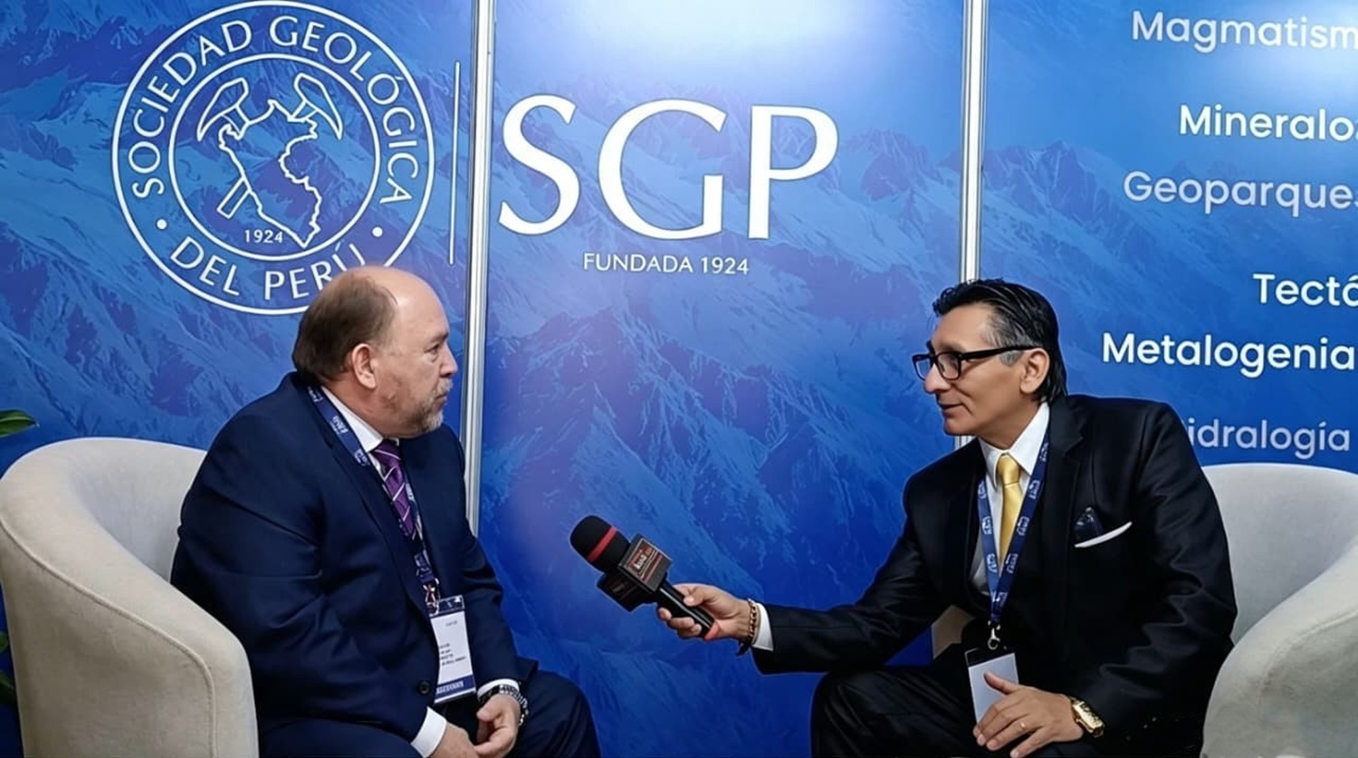
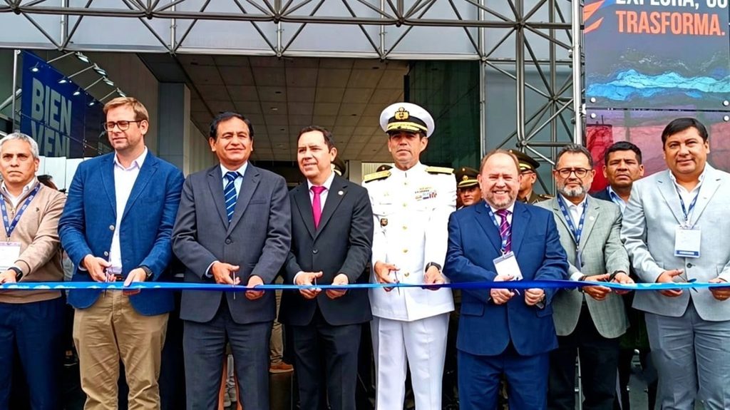
Agencia Peruana de Noticias PRENSAPERU.PE https://www.prensaperu.pe Twitter: @prensaperupe El XXIII Congreso Peruano de Geología se desarrolla del 16 al 18 de septiembre en Lima, un evento intenso en tiempo pero sumamente rico en conocimiento, donde se revisará el papel de la geología en todas las actividades que tienen impacto económico y social para el país. Así lo señaló el Ing. Carlos Bianchi Ramírez, presidente de la Sociedad Geológica del Perú (SGP), quien destacó que el Perú es un territorio privilegiado: posee gran diversidad de recursos minerales, de hidrocarburos, hídricos y de energías renovables que muchas naciones desearían tener. Sin embargo, esa riqueza conlleva también una gran responsabilidad.
Bianchi plantea con claridad un concepto central: lo que suele llamarse “desastre natural” en realidad no lo es —el desastre lo produce el ser humano por omisión o falta de previsión. El geólogo, por su conocimiento de la superficie y el subsuelo, tiene la capacidad de advertir con anticipación cuándo y dónde se presentarán eventos como sismos o el Fenómeno El Niño. En un país sísmico y expuesto a fenómenos climáticos, la prevención debe basarse en la ciencia, no en la reacción tardía.
Ante el escenario actual —con un Fenómeno El Niño que se prolongaría hasta el verano de 2027 y que los especialistas prevén extraordinario—, el ingeniero señala que hoy solo se intenta mitigar, cuando lo que debió hacerse era prevenir. “Hace falta que los geólogos no solo describan el fenómeno, sino que expliquen cómo actuar para reducir el daño”, afirma.
Advierte que construir sin un estudio geológico previo —edificios, represas, puentes— es poner en riesgo la durabilidad y la seguridad de las obras. Es el geólogo quien debe indicar desde el inicio qué tipo de construcción soporta cada suelo. Del mismo modo, recalca que no se debe permitir asentamientos en quebradas, aunque estas no se activen todos los años: tarde o temprano lo harán. Pone como ejemplo el caso de San Bartolo (Tradicional balneario y distrito ubicado en el kilómetro 51 de la Panamericana al Sur de Lima), destruido en un evento anterior, y contrasta con el saber ancestral: los incas nunca edificaban en quebradas, observaban el terreno durante mucho tiempo y elegían bien dónde asentarse; hoy con toda nuestra tecnología deberíamos hacerlo mejor, y sin embargo no siempre ocurre así.
Señala que existen leyes, pero falta actualizarlas, difundirlas y penalizar con firmeza a quienes las incumplen, especialmente a quienes construyen en zonas no aptas por ahorrarse el costo de un estudio geológico. Propone que la realización de un estudio geológico sea un requisito contractual y obligatorio para cualquier proyecto de construcción.
Ante la pregunta de nuestro director Fernando Palomares (PrensaPerú), sobre la participación de la Sociedad Geológica en la gestión municipal y regional, reconoce que lamentablemente no existe un espacio institucionalizado de consulta, aunque se ha intentado acercar a municipalidades con riesgo geológico. Destaca la iniciativa anterior de crear “Un geólogo por municipio”, proyecto de ley que quedó paralizado en el Congreso anterior, y anuncia que la Sociedad Geológica retoma la propuesta: se buscará que un diputado la patrocine en la Cámara, para luego pasar al Senado, explicando a las autoridades y sus equipos que no se trata de un interés gremial, sino de dotar a cada gobierno local del profesional capaz de decir dónde sí y dónde no se puede construir.
Finalmente, hizo un llamado a los medios de comunicación, a la sociedad civil, a las autoridades y a la comunidad científica: el objetivo principal no es solo evitar pérdidas económicas, sino salvar vidas. Es una tarea grande, pero posible si se trabaja en conjunto.
DATOS CONCEPTUALES
Geología aplicada: Rama de la ciencia que estudia el terreno, el subsuelo y los procesos naturales para orientar dónde, cómo y con qué materiales construir. No es solo describir rocas: es prever riesgos y proteger vidas y obras.
Prevención geológica: Conocimiento y acción anticipada. Consiste en identificar zonas de peligro antes de edificar o asentarse, mediante estudios técnicos. Distingue el riesgo natural de la vulnerabilidad humana.
Fenómeno El Niño: Calentamiento anómalo de las aguas del Pacífico que altera el clima y provoca lluvias intensas, huaicos y desbordes. Su magnitud y duración pueden preverse; el daño depende de cuán preparada esté la población y la infraestructura.
Estudio geológico previo: Análisis técnico obligatorio que certifica la capacidad del suelo para soportar construcciones. Su omisión por ahorrar costos genera riesgos graves de colapso, pérdida de bienes y vidas.
Gestión territorial con base científica: Planificación de ciudades, pueblos y obras guiada por el conocimiento del terreno. Implica respetar quebradas, laderas y zonas de riesgo, en lugar de ocuparlas por conveniencia o necesidad.
DATOS
1.- El verdadero desastre no es de la naturaleza: es la negligencia humana. Sismos, lluvias y fenómenos climáticos ocurren; convertirlos en tragedia depende de si ignoramos las señales, construimos mal o no nos preparamos.
2.- Prevenir cuesta mucho menos que lamentar. Un estudio geológico antes de construir salva más que cualquier obra de emergencia después del daño. La ciencia debe guiar cada decisión, no solo aparecer cuando ya hay víctimas.
3.- Lo que los ancestros sabían, la tecnología debe perfeccionar. Si las civilizaciones antiguas elegían bien dónde asentarse observando la tierra, hoy no tiene sentido ocupar quebradas y zonas que tarde o temprano se activarán.
4.- Cada municipio merece tener la voz técnica que diga dónde sí y dónde no. La propuesta de “Un geólogo por municipio” no defiende intereses profesionales: dota a cada autoridad local de la capacidad de proteger a su gente con conocimiento real.
5.- Salvar vidas es la meta, y todos pueden contribuir. Autoridades, medios, científicos y ciudadanos comparten la responsabilidad: escuchar a la ciencia, difundir la verdad y respetar el terreno puede evitar que el futuro nos sorprenda con tragedias evitables.
Fuente: Agencia Peruana de Noticias PRENSAPERU.PE https://www.prensaperu.pe Twitter: @prensaperupe
Translate
“Disaster is not natural; it arises when we ignore what the Earth is telling us,” stated Engineer Carlos Bianchi Ramírez, president of the Geological Society of Peru (SGP), at the 23rd Peruvian Geological Congress.
Peruvian News Agency PRENSAPERU.PE https://www.prensaperu.pe Twitter: @prensaperupe The XXIII Peruvian Congress of Geology is being held in Lima from September 16–18: an intense but immensely knowledge‑rich event examining geology’s role across all activities with economic and social impact nationwide. This was stated by Eng. Carlos Bianchi Ramírez, President of the Geological Society of Peru (SGP), who highlighted Peru as a privileged territory — endowed with mineral, hydrocarbon, water, and renewable energy resources that many nations would envy. Yet this wealth also carries profound responsibility.
Bianchi clearly sets forth a core concept: what is commonly called a “natural disaster” is in reality no such thing — disaster is human‑made through omission and lack of foresight. The geologist, through understanding of surface and subsurface, possesses the ability to foresee when and where events such as earthquakes or El Niño will occur. In a seismic nation exposed to climatic extremes, prevention must be science‑driven, not a belated reaction.
Regarding the current outlook — with an El Niño event projected to extend into summer 2027 and described by specialists as extraordinary — he notes that efforts now focus merely on mitigation, when prevention should have been the priority from the outset. “Geologists must do more than describe the phenomenon: they must explain how to act to reduce harm,” he states.
He warns that constructing without prior geological assessment — whether buildings, dams, or bridges — endangers structural integrity and public safety. It is the geologist who must determine from the earliest stages what each terrain can sustain. Equally, he insists no settlement should be permitted in quebradas or ravines; even if dormant for years, they will eventually awaken. He cites San Bartolo — a traditional resort district at km 51 on Lima’s Southern Pan‑American Highway — destroyed in a prior event, and contrasts it with ancestral wisdom: the Incas never built in ravines, observing the land at length and choosing sites with care. With modern technology we should do better, yet we often do not.
Laws exist, he acknowledges, but they require updating, wider dissemination, and firm enforcement against violators — especially those building in unsuitable areas solely to avoid the cost of geological studies. He proposes mandatory, contractual geological surveys as a prerequisite for every construction project.
Responding to a question from our director Fernando Palomares (PrensaPerú) on the Geological Society’s engagement with municipal and regional authorities, he confirmed no formal institutional consultation mechanism currently exists, despite outreach to municipalities in high‑risk zones. He recalled the earlier “One Geologist per Municipality” bill that stalled in the previous Congress, and announced the Society is reviving the proposal: a congressperson will be sought to sponsor the legislation, explaining to authorities this serves no professional lobby interest — it ensures every local government has the expertise to say where building may proceed, and where it must not.
He concluded with an appeal to media, civil society, authorities, and the scientific community: the primary goal is not merely avoiding financial loss, but saving lives. A great undertaking — yet achievable through shared effort.
CONCEPTUAL DATA
Applied Geology: The branch of science that studies terrain, subsurface conditions, and natural processes to guide where, how, and with what materials to build. It goes beyond describing rocks — it anticipates hazards and protects lives and infrastructure.
Geological Prevention: Knowledge put into action ahead of time. Identifying danger zones before construction or settlement through technical assessment. It distinguishes natural hazards from human‑made vulnerability.
El Niño Phenomenon: Anomalous warming of Pacific Ocean waters that disrupts weather patterns and triggers intense rainfall, landslides, and river overflows. Its scale and duration can be forecast; the resulting harm depends on how prepared communities and infrastructure are.
Preliminary Geological Survey: Mandatory technical analysis verifying a site’s ability to support construction. Skipping it to save costs creates serious risks of structural failure, loss of property, and loss of life.
Science‑Based Land Management: Planning cities, towns, and infrastructure guided by actual terrain knowledge. It means respecting ravines, slopes, and hazard zones rather than occupying them out of convenience or need.
DATA
1.- True disasters are not natural — they stem from human neglect. Earthquakes, storms, and climate events occur; they become tragedies only when we ignore warnings, build unsafely, or fail to prepare.
2.- Prevention costs far less than recovery. One geological assessment before construction saves more than every emergency response after disaster strikes. Science must lead — not follow — decisions.
3.- If ancient wisdom chose wisely, modern technology should do better. Earlier civilizations settled only after observing the land; today there is no justification for occupying ravines and areas that will eventually fail.
4.- Every municipality deserves clear, expert guidance on where to build. The “One Geologist per Municipality” proposal serves no professional interest — it equips local leaders with the knowledge to keep their communities safe.
5.- Saving lives is the goal, and everyone has a part to play. Authorities, media, scientists, and citizens share the duty: listen to science, spread the truth, and respect the land — we can prevent avoidable tragedy.
Source: Peruvian News Agency PRENSAPERU.PE https://www.prensaperu.pe Twitter: @prensaperupe